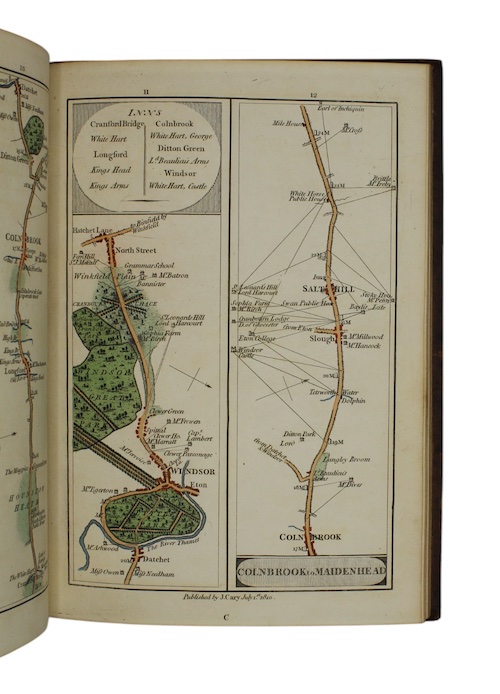
Cary's Survey of the High Roads from london...
London.
Printed for J. Cary, July 1st. 1810
Quarto.
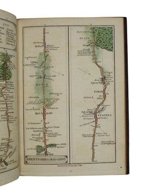
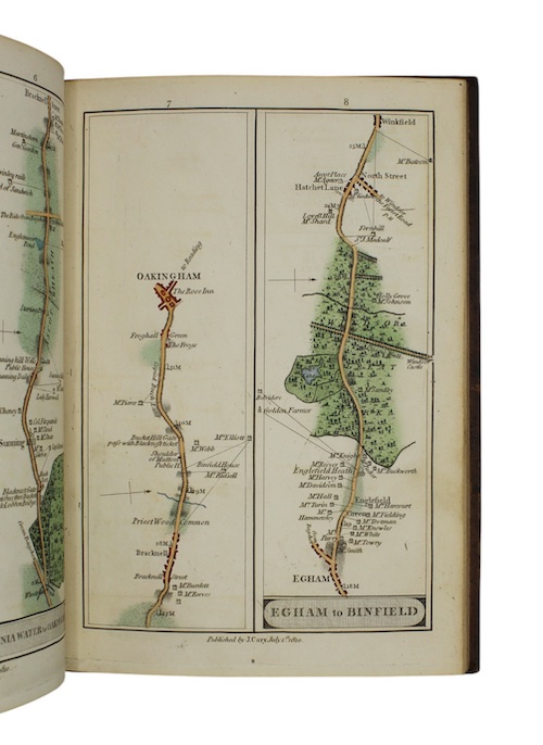
[44] leaves. Engraved throughout. Hand-coloured strip road maps are printed in eighty numbered columns on both the recto and verso of 40 leaves. A handsomely bound copy in contemporary mottled calf, ruled in gilt and blind, contrasting black calf lettering-piece. Lightly rubbed, spine sunned. Very occasional light spotting.
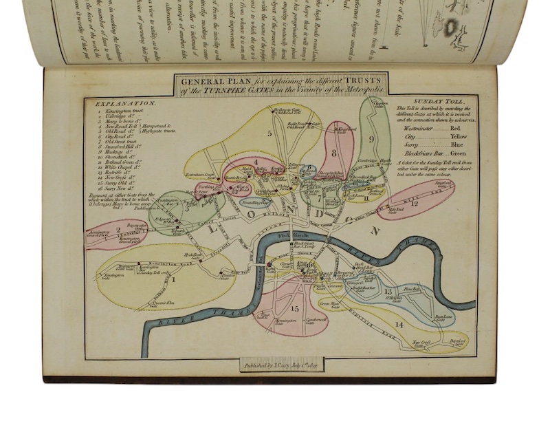
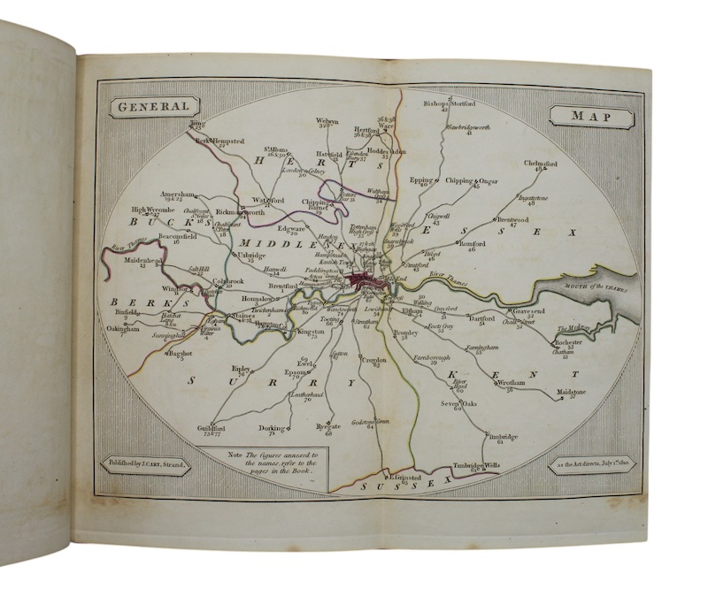
The final edition of cartographer John Cary's (1755-1835) atlas, executed to his typically high standards, showing the major routes out of London to destinations including Hampton Court, Windsor, Maidenhead, High Wycombe, St. Albans, Welwyn, Hertford, Chelmsford, Maidstone, and Tunbridge Wells. In addition, the maps depict 'every Gentleman's seat, situate on, or seen from the Road...with the Name of the Possessor; to which is added the Number of Inns on each separate Route; also, the different Turnpike Gates, shewing the Connection which one trust has with another'. The English Review (Vol. XVII, 1791, p.386) said of the work: 'We consider it as an entertaining and useful companion to the numerous travellers who are constantly issuing from every quarter of this immense metropolis'.
£ 950.00
Antiquates Ref: 25745